Neil Peart's News, Weather and Sports
BubbaGram™#3
NeilPeart.net, November 30, 2015
 |
In a Big Country |
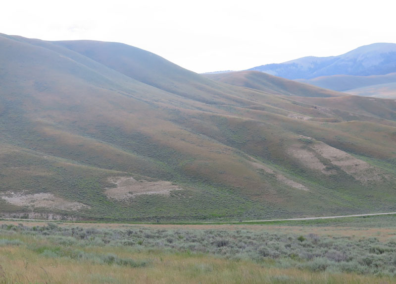
It was mid-July 2015, a day off between shows in Salt Lake City and Calgary on the third and final leg of the R40 tour. The setting is the Bannock Pass, an unpaved route between Idaho and Montana. The wide, well-graded gravel curved upward through a treeless expanse of sagebrush and grasses rising to 7,684 feet. A closer look at the photo shows two tiny motorcyclists, Chris and Michael, riding across the lower middle. It was indeed a big country. Just to the north, the Lemhi Pass had been the route of the Lewis and Clark expedition in 1805-and until 1846 that very spot marked the western border of the United States. Stories and history everywhere.
Not long after crossing into Montana and onto a paved road, I led us off-pavement again. Right away Dingus (GPS unit) started-well, freaking out. No other way to put it. One minute he would know what road I was on, and where we were headed, the next he'd be "recalculating," then suggesting I make a U-turn. As usual, I just pressed on in the general compass direction I wanted, ignoring Dingus until he came up with some useful information.
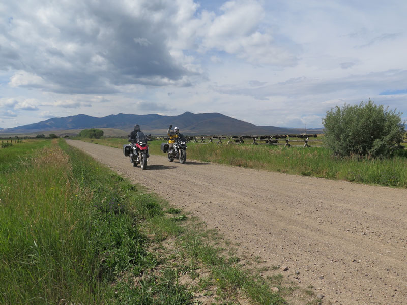 |
Chris and Michael, Montana |
The style of fencing in the background is called buck-and-rail (that was not easy to find out!), and seems characteristic of the Idaho-Montana region. I learned that it is often preferred in Western areas because it doesn't require post-holes-useful if the ground is rocky and you need to fence in your livestock. To this traveler's eye, buck-and-rail fences are pretty against the grasslands and distant peaks.
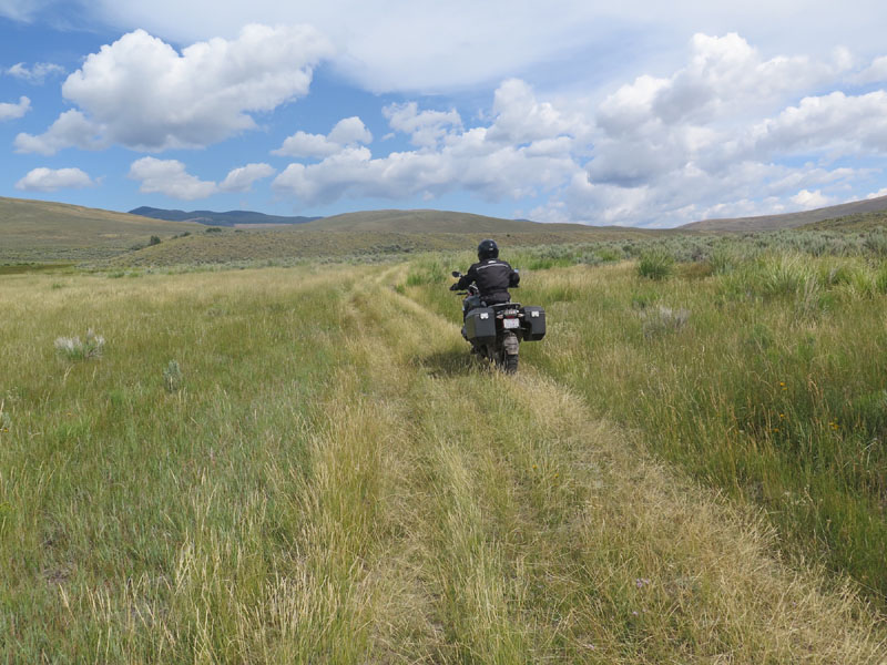
Shortly after this photo was taken the three of us were pootling along single-track trails through sagebrush and tall grasses. Sometimes the track led down a steep ravine, often with a rocky wash at the bottom, then a steep, rutted climb uphill. It was hard, sometimes tricky riding, especially for Chris, who was well experienced on pavement, but not this kind of terrain. Free-range livestock were a threat around there, and several times I had to stop and open a series of barbed-wire gates, then close them behind us. At one I paused for a minute before opening it, because a huge black bull, with a massive pendulous scrotum, was standing on the other side, regarding me. I parked, turned off the engine, and stood at the rail, but the bull didn't seem disturbed. I opened the gate and waved the other guys through. "Michael, you go first!"
 |
"It is So a Road!" |
And still, as the "responsible leader" of this little expedition, I had no clue if we were on the "right" route or not. Or any kind of route at all, really. A lot of times it was just tracks through the grass, or ruts through dried mud and rocks. After meandering around for a couple of hours, as close to north and east as I could keep us, I saw windpumps and water tanks, then a more well-traveled track leading toward distant ranch buildings. Figuring it was time to cut our losses and get back on a road, I led us that way. We still needed to travel the entire south-to-north expanse of Montana to get to Glacier National Park that day.
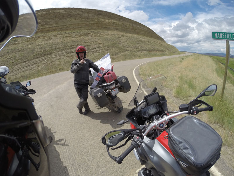 |
Bubba and the Map and the Incredible Sign |
Out through the ranch's driveway we rode, triumphant-we had conquered the wilderness! We reached an intersection with a paved road and I waved us to a stop at the roadside. Time to figure out where we were, where gas was, and where to go from there. I unfolded the paper map of Montana to plot some strategy, and Dingus had found his bearings by then and was ready to help.
I looked over at the street sign, Mansfield Lane, and my eyes widened in disbelief. The name had stuck in my memory because a friend used to live near Mansfield, Ohio, and-Mansfield Lane was exactly where we had turned off the pavement, two hours and all that struggle ago.